Cultural heritage and History

Artist impression showing exposed midden area ©
The nation’s first people
The Bunurong people occupied these lands for thousands of years before white settlement and their existence is evidenced by the extensive midden areas along the shores. Middens are usually well below the surface but over eons of time sand has blown across the bay and covered them. Occasionally either a small landslip or geographical change in the landform exposes these shell middens and as these areas are of significant cultural heritage, we do not disturb them out of respect for the first people’s culture.
Collins Settlement
The next settlers forming a historical link with our area were the free settlers and convicts who arrived in 1803 under the control of lt. Governor David Collins of the British navy. Collins attempted to establish a settlement that only lasted seven months. He was defeated by lack of potable water, arable land, and other factors that saw the settlement move to, and establish, Hobart in Tasmania in 1804.

Collins Settlement statue

Image Courtesy of Rye Historical Society
Rye Township
The Whitecliffs Foreshore Reserve coastal strip was gazetted as a town in 1861 and some of the earliest settlers from that area started the lime burning, timber cutting, and fishing industries. The Cain family (one of the earliest families) are acknowledged along Point Nepean road by the street names: the Cain family whose home was named ‘Tyrone’ after their homeland is represented in Rye by Cain & Tyrone streets, with family members John and Neville (Miss Main married Mr Neville) and of course, the beach area is known locally as Tyrone beach. The Sullivan family were also very early settlers and followed the lime burning industry with timber cutting for the burgeoning Melbourne population.
Canterbury Jetty Road
Canterbury Jetty Road forms the border between Rye and Blairgowrie. In the early days, it derived its name from a jetty used by the lime burners of the district to have their products shipped to Melbourne. When lime burning declined the area’s trees were exploited for Melbourne’s bakeries which needed a good supply of wood with high burning qualities. Once again, the jetty served a purpose.

Artist’s impression of the jetty in use
Blairgowrie Village
The village was originally the site of an abattoir and butchery run by the Wilson family on the corner of St Johns Wood road. Once again street names in the surroundings – Wilson, Mary-Rose, Maxwell, Godfrey, and Charles acknowledge the family’s existence. Blairgowrie remained a sleepy village surrounding the 1874 historic Blairgowrie house for many decades with an upsurge in development in the post-WWII era. Today it is a thriving and sought-after destination with an active community group (community 3942) that keeps the public aware of local news through the village notice board outside the IGA. Also in Blairgowrie is the yacht squadron, established in 1952 for sailing enthusiasts. Today it houses a 350 berth marina and headquarters of the Southern Peninsula Rescue Squad. The marina walls also offer divers and snorkelers an opportunity to marvel at the marine life encountered there and are a very popular diving destination.
The Lime Burning Industry
The industry continued through the 1870s and Camerons Bight is named after HG Cameron and Hughes road after the Hughes brothers who were all lime burners in the district. In 1875 fishermen and their families settled permanently in coastal areas and the Hutchins family had a jetty named for them on the site of the current Camerons Bight jetty which remained until 1972. There is a concrete slab in the car park on the corner of Hughes Road and Point Nepean road which formed the base of a ‘shed’ where fresh fish could be purchased until the late 1950s.

Hutchins Jetty from Rose Series Postcard 1950s
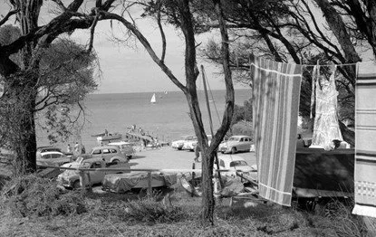
Camping – 1950s style
Camping
Prior to WWII a movement of people wanting to get out and about started and so ‘camping’ as we know it today, began. In December 1954 camping commenced on the beachside of Hughes Road with sixty sites. That original concept has grown over the years to 169 sites stretching from Hughes rd on the border of Blairgowrie and Sorrento to Whitecliffs in Rye, an area of approximately 6 km.
Boat Sheds
Whilst fishermen traditionally had sheds along the shores, it was in the 1950s that private beach boxes began appearing along our shoreline. These were primarily used as a way of housing dinghies and tenders for the local residents who lived some distance from the beach. The beach boxes spared owners the task of packing their equipment on cars and trailers for the return trip home at the end of a day at the beach. Today’s beach boxes are still used for much the same purpose and owners display many decorative artworks and colours adding to the seaside atmosphere.

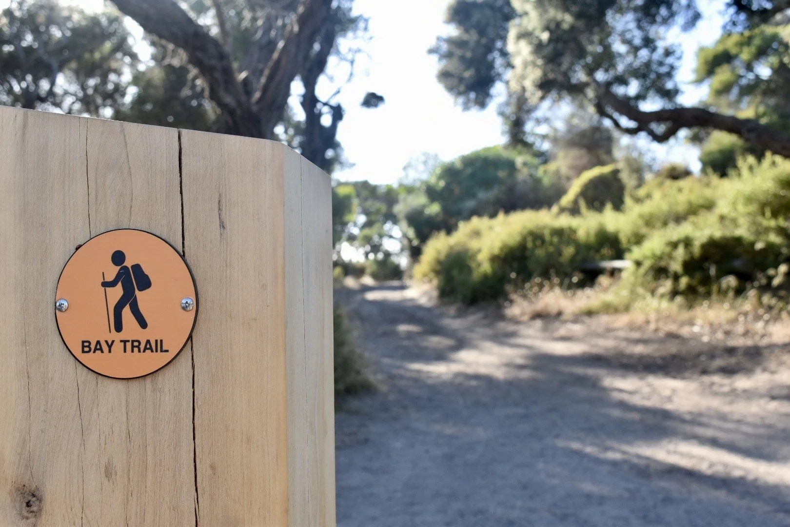
The Baytrail
The scenic coastal trail runs along many parts of Port Phillip Bay. Through our management area, it is generally a sandy trail for walkers. In some parts, the land space between the beach and Point Nepean Road is very narrow and walkers are advised at these points to choose the shared, sealed path on the south side of Point Nepean Road which runs the entire length from Hughes Road to Rye township. A walk along the trail is enhanced by interpretive signage referring to the district’s history, local vegetation, marine, fauna, and birdlife.